MArch Architectural Studies School of Architecture
Zhoujie Yu
Self Introduction
Zhoujie Yu is a postgraduate student at the Mackintosh School of Architecture, Glasgow School of Art. With a background in urban planning and architecture from Shanghai University, his academic focus lies in the intersection of urban regeneration, spatial analysis, and sustainable design. His research particularly explores how Space Syntax and the 15-Minute City framework can be applied to evaluate and redesign neighbourhoods for better accessibility and community well-being.
Project Description
Title: Community Accessibility through a Dual-Lens Approach: A 15-Minute City Analysis of Laurieston, Glasgow
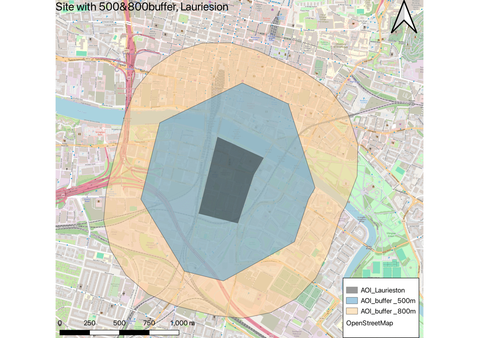
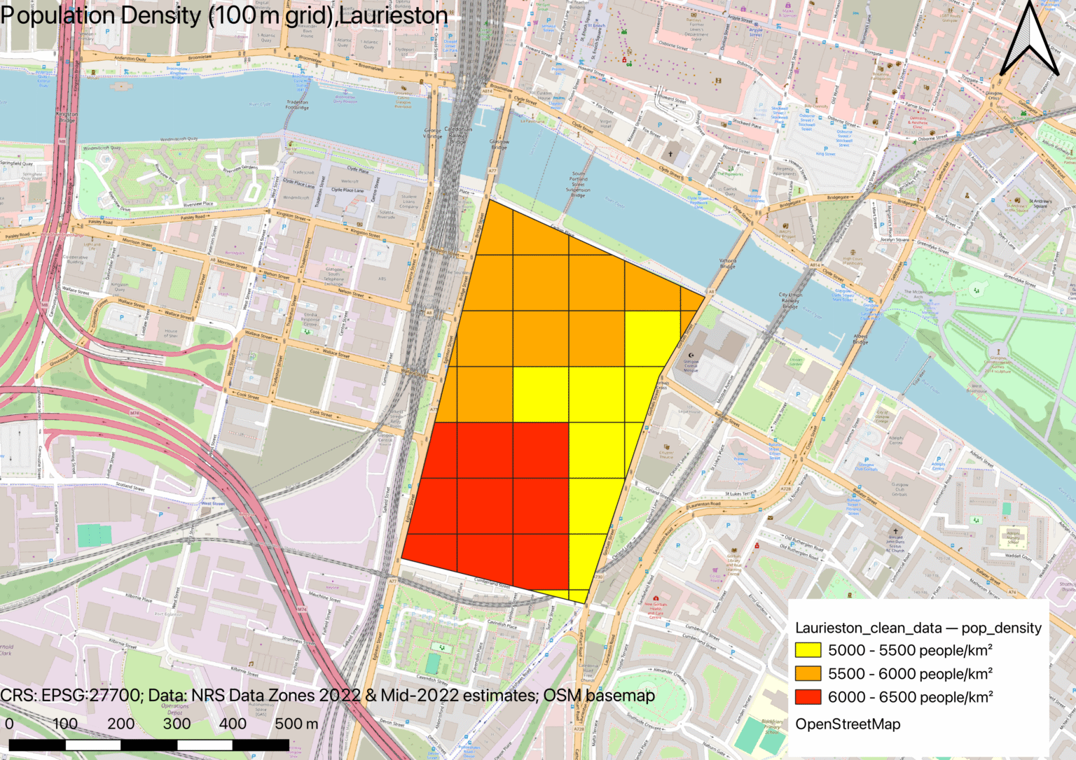
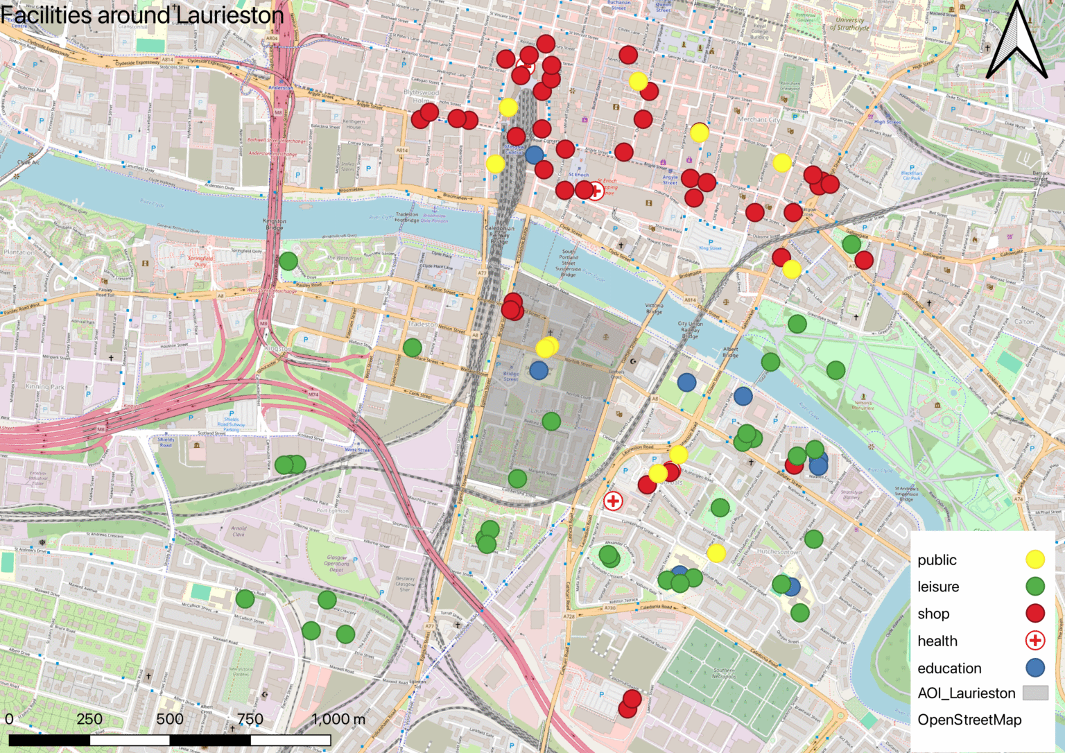
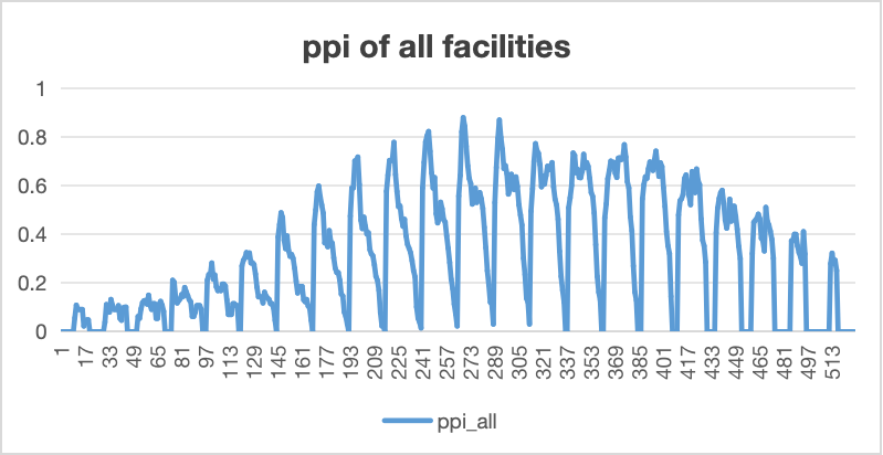
This research investigates the spatial and social dimensions of the 15-Minute City through a case study of the Laurieston neighbourhood in Glasgow. The study applies Space Syntax theory and GIS-based accessibility analysis to examine how street networks and service distributions influence everyday urban life.
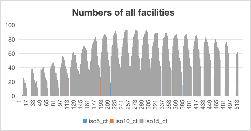
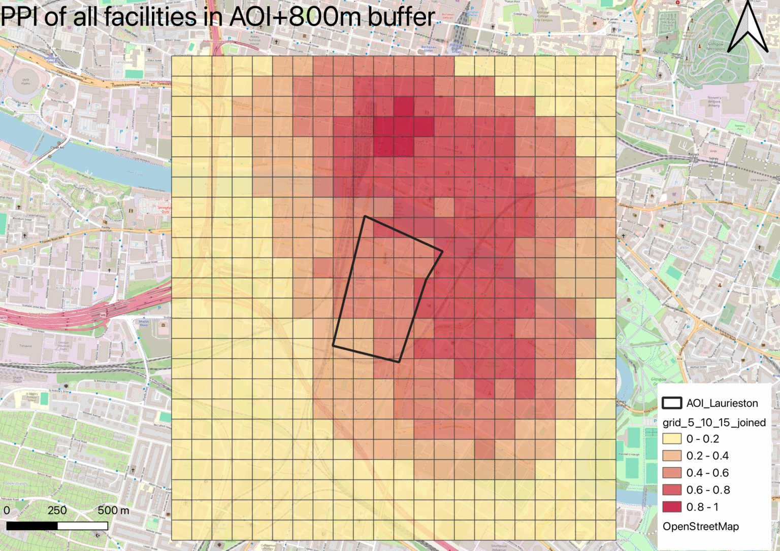
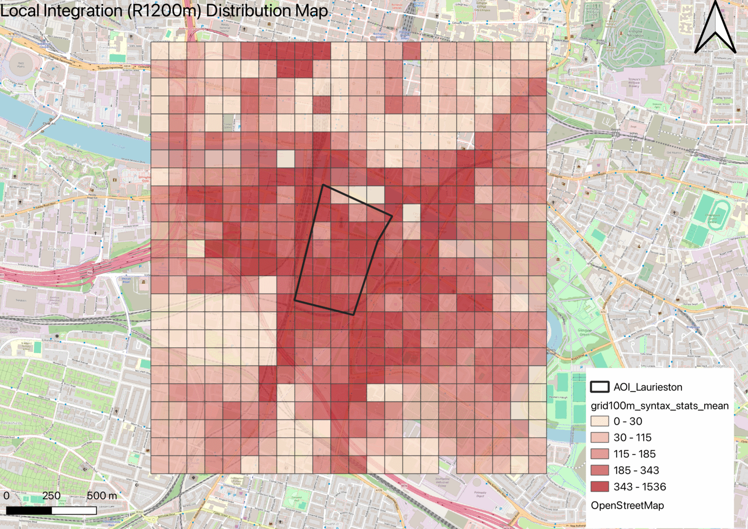
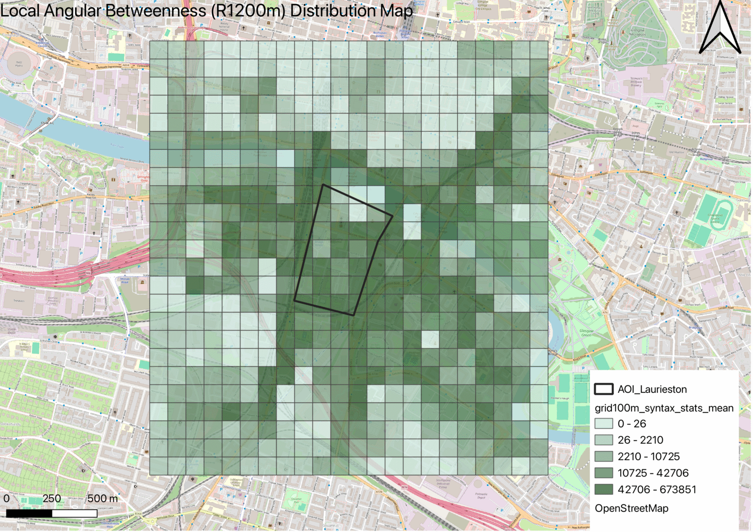
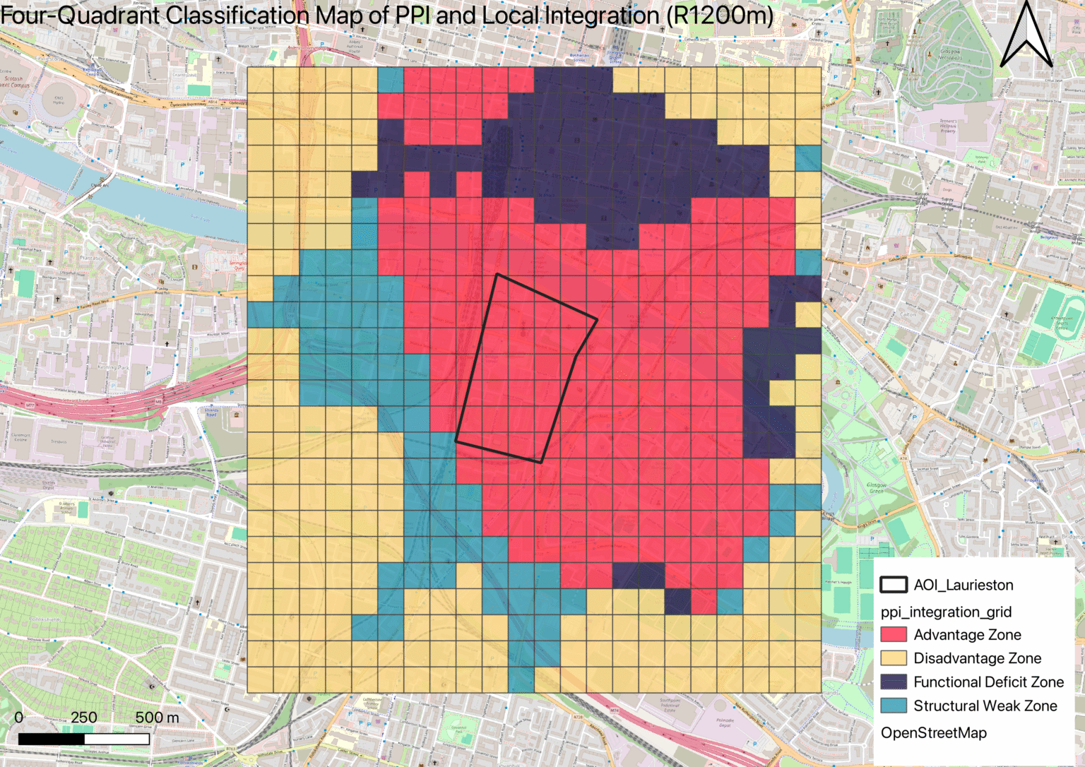
The methodology combines segment integration analysis, isochrone mapping, and proximity indices, offering a multi-layered understanding of accessibility within the community. Findings highlight the strengths and limitations of Laurieston’s current urban structure, identifying zones of high connectivity as well as areas of functional deficit.
Beyond site-specific outcomes, the project aims to contribute to broader discussions on urban regeneration and sustainable neighbourhood design, providing analytical tools that can inform future planning strategies for resilient and equitable cities.
Living within Walking: Community Accessibility through a Dual-Lens Approach: A 15-Minute City Analysis of Laurieston, Glasgow
This research investigates the spatial and social dimensions of the 15-Minute City through a case study of the Laurieston neighbourhood in Glasgow. The study applies Space Syntax theory and GIS-based accessibility analysis to examine how street networks and service distributions influence everyday urban life.
The methodology combines segment integration analysis, isochrone mapping, and proximity indices, offering a multi-layered understanding of accessibility within the community. Findings highlight the strengths and limitations of Laurieston’s current urban structure, identifying zones of high connectivity as well as areas of functional deficit.
Beyond site-specific outcomes, the project aims to contribute to broader discussions on urban regeneration and sustainable neighbourhood design, providing analytical tools that can inform future planning strategies for resilient and equitable cities.