
Yutian Fan
(Fanny)
Hi,
I am here.
And I like looking at things people usually walk past.
Exploring the curious relationship between people, technology and the more-than-human world, I like looking at the things we usually overlook — a feather on the road, a trace left behind, a quiet encounter between a person and the environment — and asking, “What else could this tell us?”
My practice moves between interaction design, visual communication and physical making. I enjoy turning small observations and overlooked issues into tangible experiences, digital tools and visual systems that invite people to stop, notice, and think a little differently.
For me, design is not always about making things smarter or more efficient. Sometimes, it is simply about helping us see what was already there.
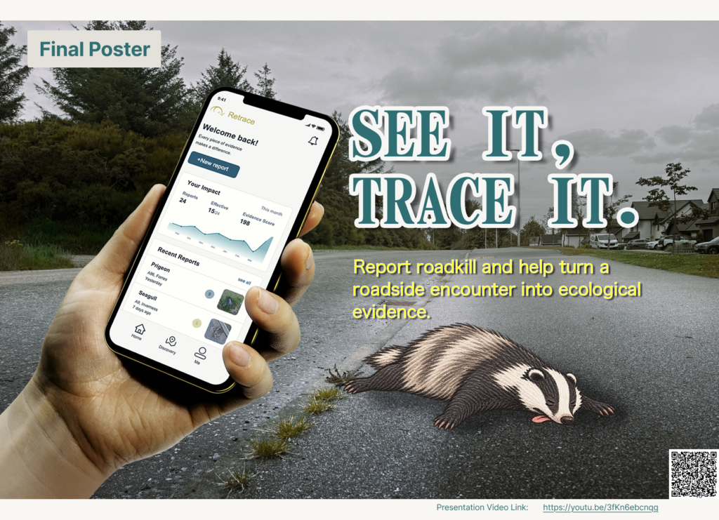
RETRACE: From Encounter to Action
Look!
There’s an animal lying dead on the road.
What do you think when you see it?
Do you drive past?
Do you stop?
Do you wonder what happened?
For most of us, it is probably just something we notice for a few seconds before continuing our journey.
But what if this small encounter could tell us something?
Retrace started with a simple question: what happens to an animal after we leave it behind?
Roadkill is often reduced to a point on a map — a species, a location, a date. But a carcass is more than a data point. It can be a trace of movement, habitat, infrastructure, and an encounter between humans and other animals.
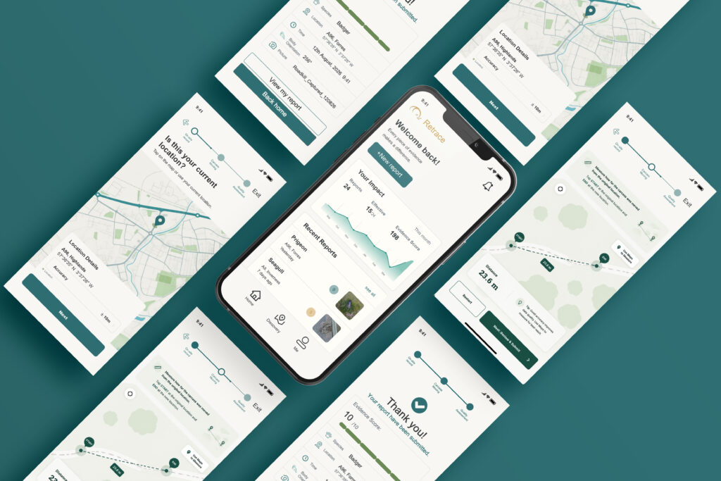
Retrace is a reporting system designed to help people document these overlooked encounters in a simple and meaningful way.
You don’t need to be a wildlife expert. You don’t need to know exactly what species it is, how far the body has moved, or which direction it was facing. Retrace helps with the things that are difficult to judge, while allowing people to focus on what they can actually see.
A photograph.
A location.
A body left on the road.
A feather carried away by the wind.
Each observation becomes a trace.
And when these traces come together, they can reveal patterns that a single encounter could never show — helping us understand the roads we build, the animals that cross them, and the environments we share.
Perhaps this is what Retrace is really about:
not just recording how an animal died, but remembering that it was here.
Life and death have their own course.
Some lives may seem light as a feather; others carry the weight of a mountain.
Either way, they leave a trace.
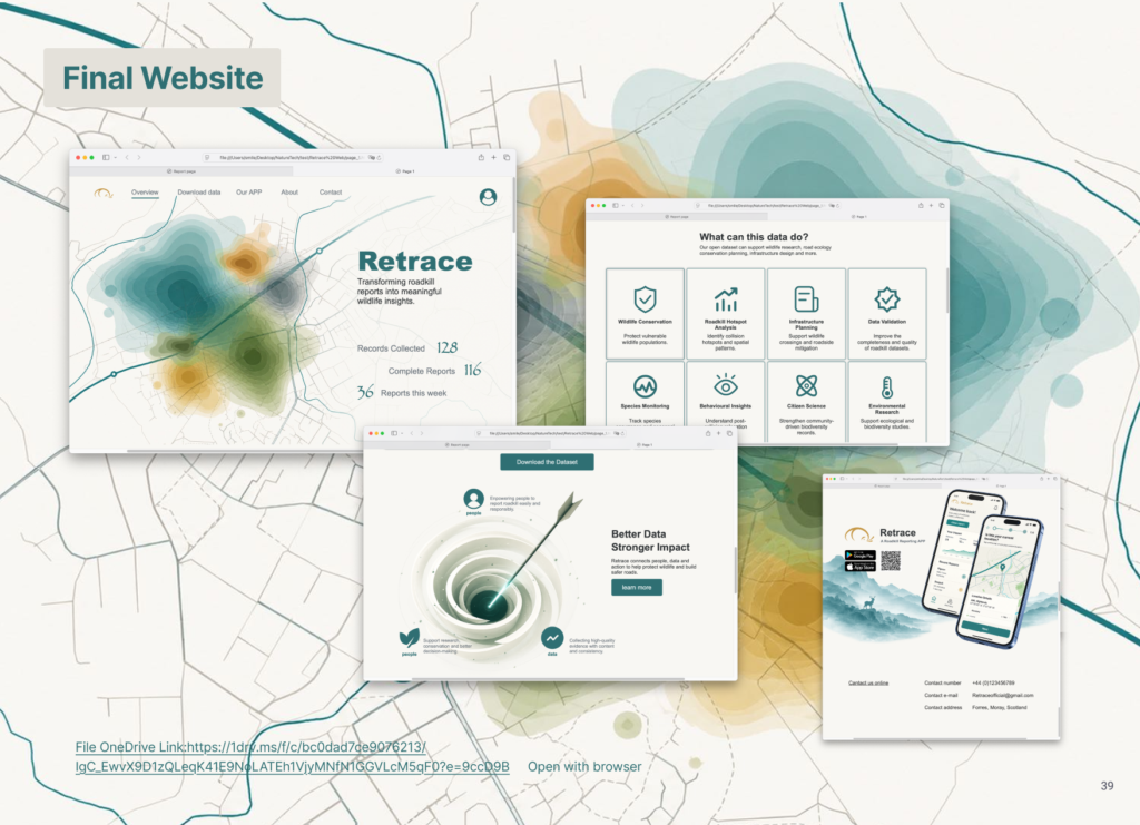
A service system for preserving and connecting roadkill evidence.
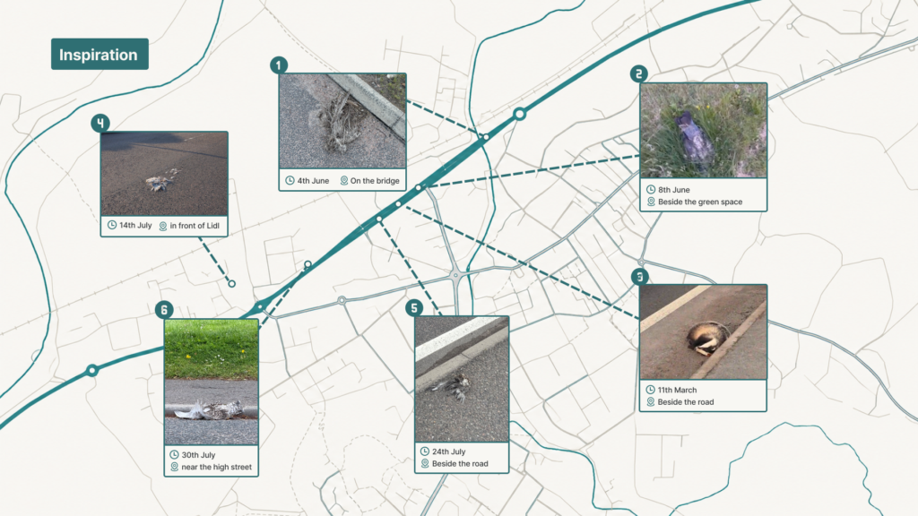
Between May and July, I repeatedly encountered the bodies of wild animals along the roadside, most of them birds. At first, I simply wondered why they kept appearing in the same places. Were they crossing the road? Were these isolated accidents, or part of a larger pattern? I realised I had far more questions than answers.
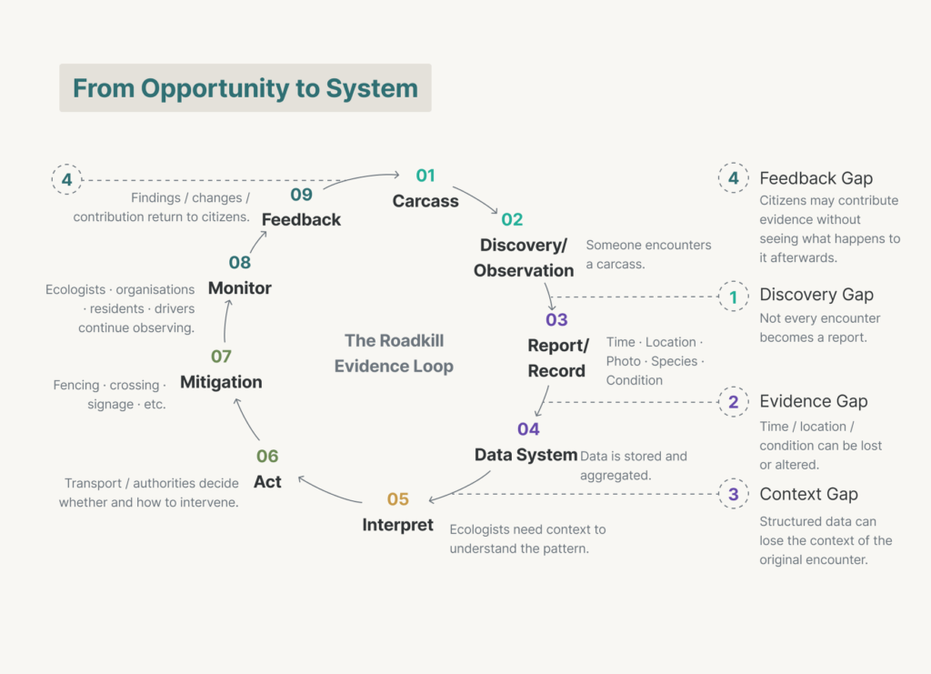
The opportunity suggested that preserving evidence could not be solved by improving the reporting interface alone. Evidence moves through a wider network of people, organisations and infrastructures, from the moment a carcass is discovered to its eventual interpretation, action and monitoring. I therefore shifted from designing a reporting tool to designing the journey that allows evidence to be captured, transferred and returned through the system.
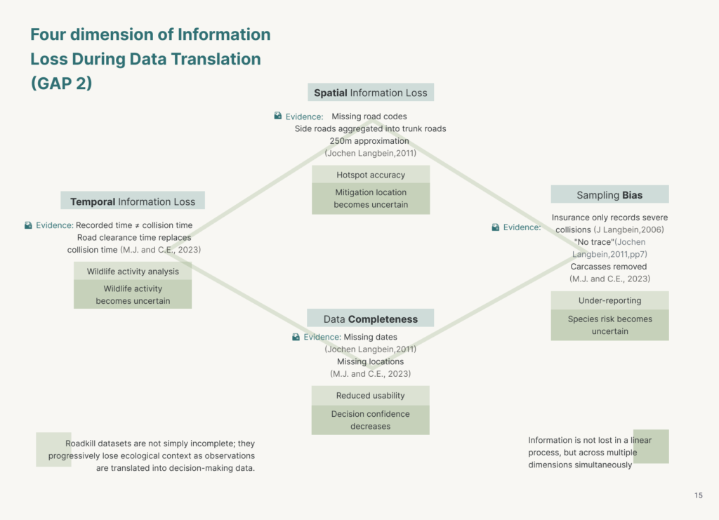
Four gaps emerged when examining how evidence moves through the system. First, not every collision becomes a record. A later NatureScot analysis found that 12% of DVC records were reports of dead or injured deer that were subsequently not found, often recorded as “no trace”; the report suggests that some carcasses may have been removed by third parties. Second, recorded evidence does not always retain precise spatial information. Some records lacked adequate location details, while later analysis found that attempts to locate reports within the database could create an apparent lack of clustering. Such inaccuracies required manual review of blackspots before their reliability could be assessed. Third, coverage is uneven across the road network. Among more than 1,500 mapped SSPCA DVC records, 18% related to trunk roads while 82% occurred on non-trunk roads, showing how different reporting sources can represent different parts of the network. Finally, incidents that do not produce significant vehicle damage may remain invisible to insurance-based reporting. Insurance records would miss collisions where a deer was killed or injured but the vehicle suffered no significant damage .