
Shuhan Lin
Focusing on urban regeneration, public space and industrial heritage, I am interested in how design can strengthen connections between people, existing buildings and the wider city. My current project explores the reconnection of the canal edge at Speirs Wharf, Glasgow.
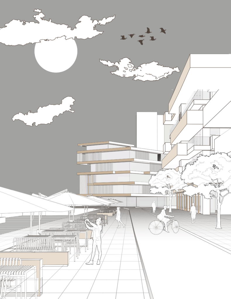
Revealing the Lost Edge — Reconnecting the Forth and Clyde Canal at Speirs Wharf
This project investigates the possibility of an innovative cultural-led regeneration of Speirs Wharf, Port Dundas, Glasgow, to connect it back to the Forth and Clyde Canal. Although there has been a strong industrial history in the area, many industrial buildings and functions have since vanished. Adaptations to roadways, infrastructure and the urban fabric have also diminished the connection between the canal and their associated streets and buildings.
The research areas are industrial heritage, public space, pedestrian access and canal edge and culture-led regeneration. Figure ground and historical maps were used to gain understanding of the area’s changes from the 1860s till present. However, there were a number of issues identified during the site analysis, such as the lack of a single pedestrian route, fenced areas, the lack of canal crossings and a level change of approximately seven meters. This makes access to the canal more challenging, and diminishes the canal’s contribution as a normal public space.
The design concept is driven by three concepts—Reveal, Reconnect and Activate. Reveal is about maintaining the industrial feel of Speirs Wharf and harnessing the remaining heritage as an element of its identity. Reconnect addresses the physical barriers with new pedestrian routes, and a stepped landscape and east–west pedestrian bridge. Activate adds new cultural and public uses along the edge of the canal.
The final proposal calls for a museum, which will serve as a cultural anchor, new public spaces, a stepped landscape and a pedestrian bridge across the canal. When viewed as a group these interventions provide a more connected relationship between the historic buildings and new development, public space and water.
The project will seek to convert the canal edge from being a fractured and hard to reach space into a more open and welcoming public area, whilst maintaining the industrial heritage of Port Dundas in the development of the canal edge.
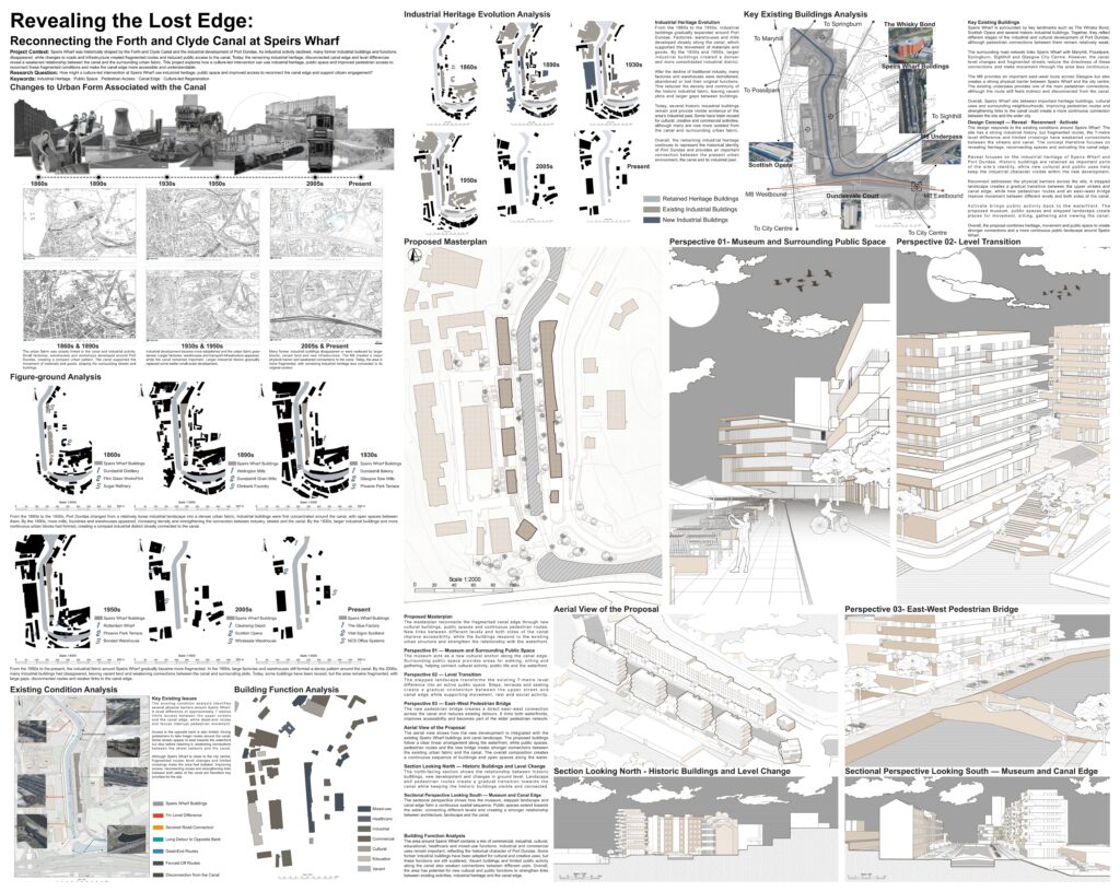
Final urban design presentation board showing the analysis, design development and proposal for Speirs Wharf, Glasgow.
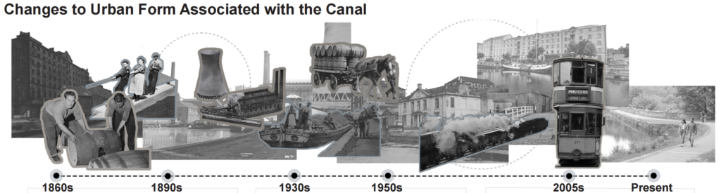
Historical timeline illustrating the transformation of the canal area from an industrial landscape to its present urban condition.
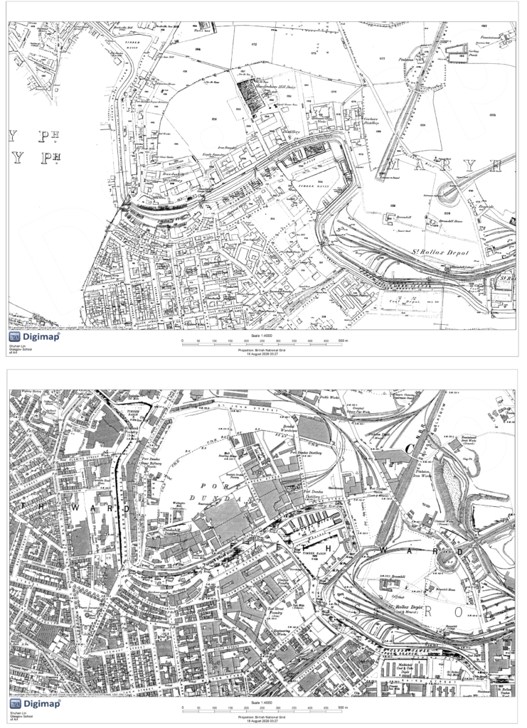
Comparison of the Port Dundas canal area in the 1860s and 1890s, showing the growth of industrial buildings and surrounding urban development.
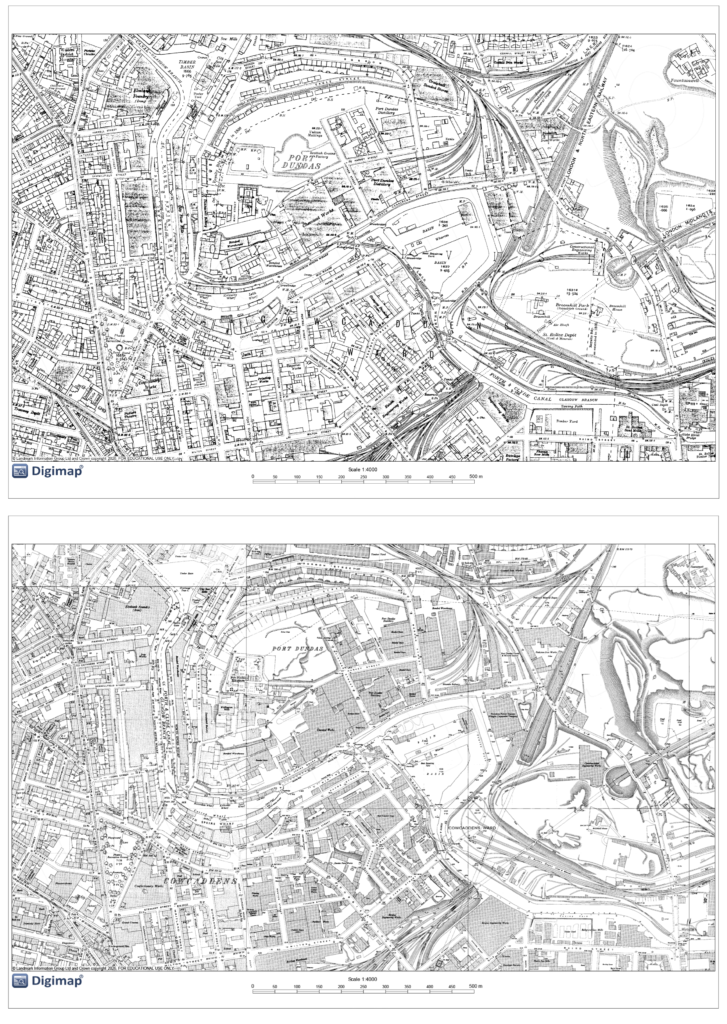
Comparison of the Port Dundas canal area in the 1930s and 1950s, showing changes in industrial development and the surrounding urban fabric.
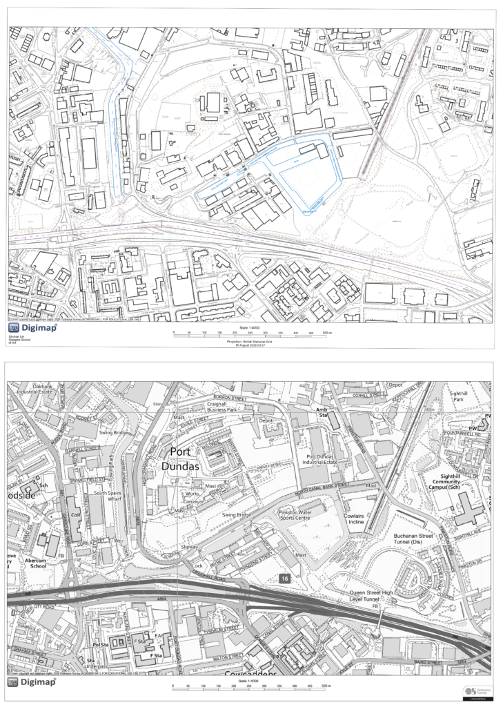
Comparison of the Port Dundas canal area in 2005 and the present, showing recent changes in buildings, infrastructure and the surrounding urban fabric.
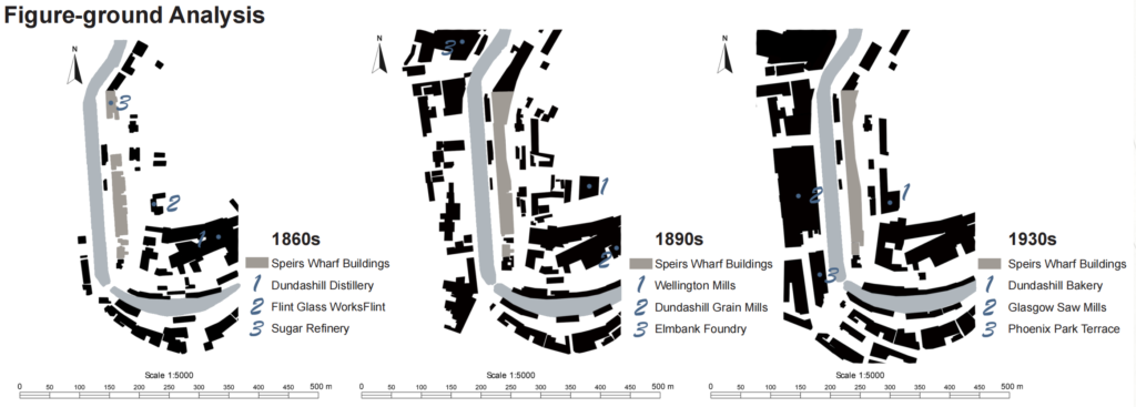
Comparison of the urban form around Speirs Wharf in the 1860s, 1890s and 1930s, showing the growth and transformation of industrial development.
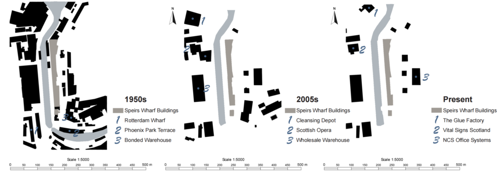
Comparison of the urban form around Speirs Wharf in the 1950s, 2005 and the present, showing changes in building density and the remaining urban fabric.
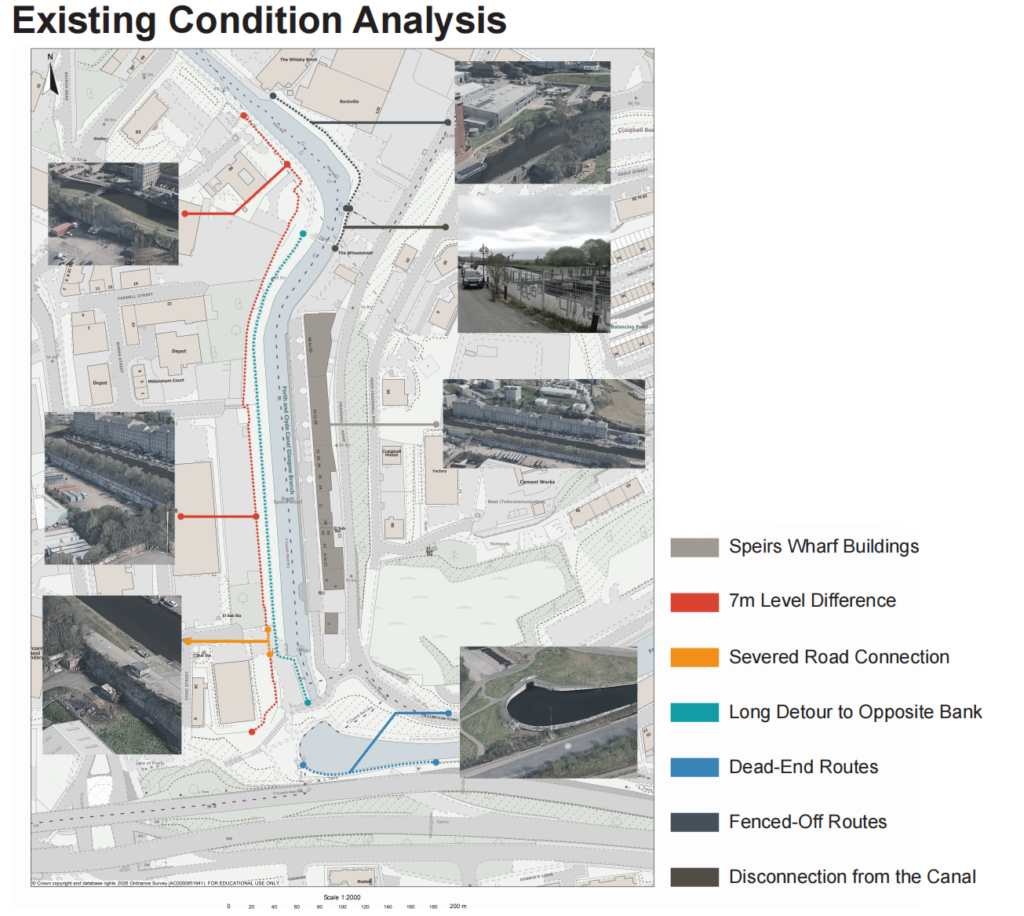
Site analysis identifying the main physical and access issues around Speirs Wharf and the canal edge.
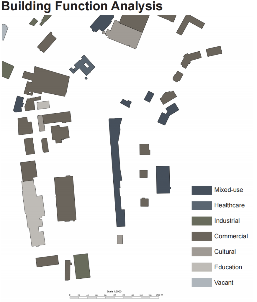
Analysis of existing building uses around Speirs Wharf and the surrounding canal area.
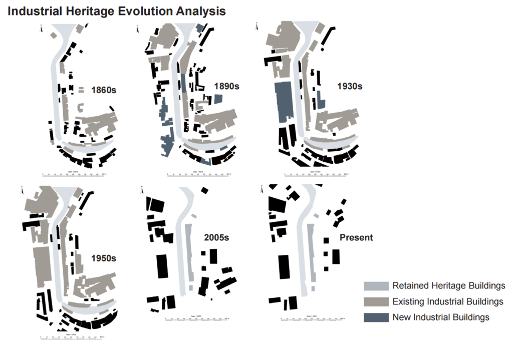
Comparison of industrial development around Speirs Wharf from the 1860s to the present, highlighting changes in industrial buildings and retained heritage.
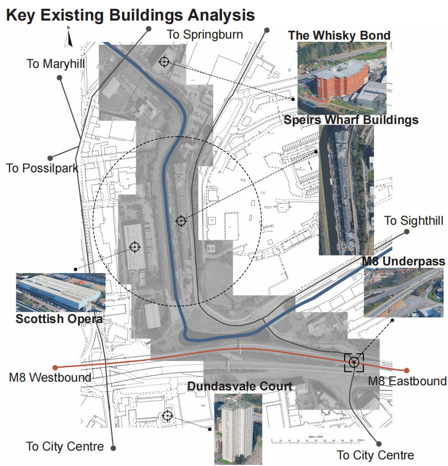
Analysis of key buildings, infrastructure and wider urban connections around Speirs Wharf.
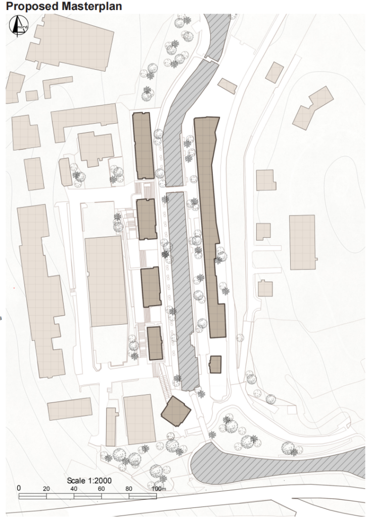
Masterplan showing the proposed spatial arrangement, new buildings and public realm improvements along the canal at Speirs Wharf.
Perspective view showing the proposed public space and pedestrian environment along the canal edge.
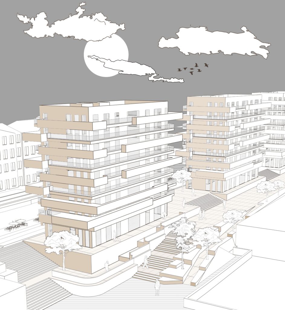
Axonometric view showing the proposed buildings, stepped landscape and pedestrian connections across the site.
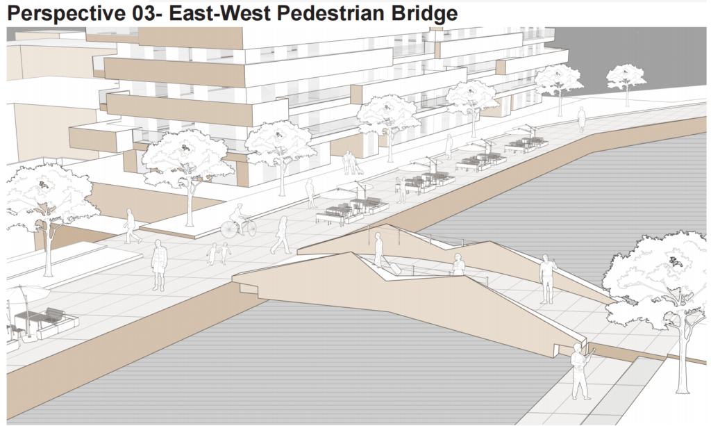
Perspective showing the proposed pedestrian bridge and its connection to the canal-side public space.
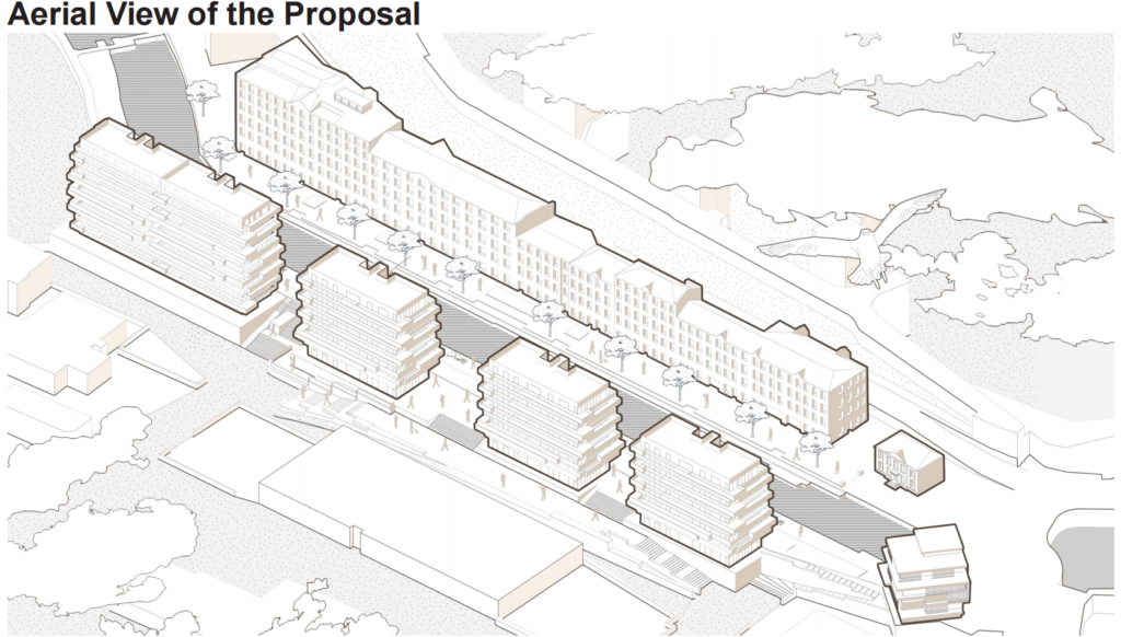
Aerial view showing the overall spatial arrangement of the proposal and its relationship with the canal and surrounding urban fabric.
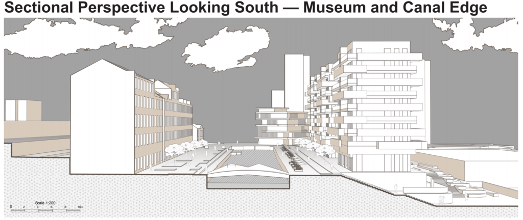
Sectional perspective showing the relationship between the proposed museum, canal edge, surrounding buildings and public space.
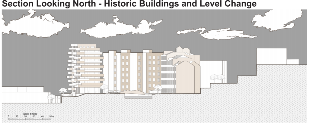
Section showing the relationship between historic buildings, proposed development and changes in ground level across the site.