
Yu Rao
(she/her)
Master’s Student in Architecture | Spatial, Social and Environmental Research
I am currently pursuing a Master’s degree in Architecture at The Glasgow School of Art. My design practice focuses on the relationship between architecture, urban environments and everyday life, exploring how space can respond to continually evolving social, cultural and ecological contexts.
Throughout my studies and design practice, I have developed a particular interest in the character of place, community relationships, the adaptive reuse of existing buildings and sustainable design. My process often begins with site-based research and spatial observation, supported by drawing, physical modelling, digital modelling, material investigation and spatial storytelling. Through these methods, I seek to understand both the visible physical conditions of a site and its underlying social and cultural narratives, translating my findings into considered spatial strategies.
For me, architecture is not simply the organisation of form, function and structure; it is also a medium that connects people with place, and the past with possible futures. This perspective has informed both my graduate project and previous work, encouraging me to approach architectural questions through multiple dimensions, including social relationships, historical context, environmental responsibility and user experience.
Through my work, I aim to establish a meaningful balance between architectural expression and practical needs. By employing careful and considered spatial interventions, I hope to create environments that are inclusive, adaptable and capable of fostering a sense of emotional connection.
Bridging Govan and Partick: new footbridge crossings as catalysts to rethinking riverside identities
Based on the theory of urban riverside regeneration, walkable cities and riverbank design, this study explores the relationship between pedestrian bridges, riverside buildings and public waterfront spaces. Through on-site analysis, case studies and design exploration, it studies how the new cross-river connection can repair broken urban structures, reconnect Govan and Partick, and support new forms of riverside public life.
I analyzed cases including Amsterdam Eastern Docklands, Hamburg HafenCity and Copenhagen Sluseholmen to find out the principles that can be learned from, such as continuous waterfront public space, permeable urban blocks, active low-level spaces, flood control adaptive design and integrated pedestrian networks. These principles provide guidance for the master planning and spatial programming of Water Row and the Wider Riverside Water District. In 2024, the completion of the Govan-Partick pedestrian bridge restored the historic cross-river connection and also provided an opportunity to rethink the relationship between the local community and the River Clyde.
The study believes that pedestrian bridges should not only be seen as transportation facilities, but should be seen as part of a broader network of urban renewal. By connecting public spaces, riverside development and walking routes, the proposal aims to activate idle land, strengthen the characteristics of waterfront areas, and create a more accessible, walkable riverside community adaptable to climate change. In the end, the study shows that a comprehensive pedestrian bridge network can support the regeneration of post-industrial areas and the redefinition of the identity of historical waterfront areas at the same time.
Keywords: river-edge buildings, urban riverfront identity, footbridges
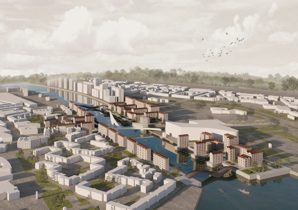
This aerial view illustrates the overall relationship between the project, its waterfront setting and the surrounding urban fabric. Buildings of varying scales are organised along the waterway, while bridges, pedestrian routes and public spaces strengthen connections between the two banks, creating a continuous, layered and vibrant waterfront environment.
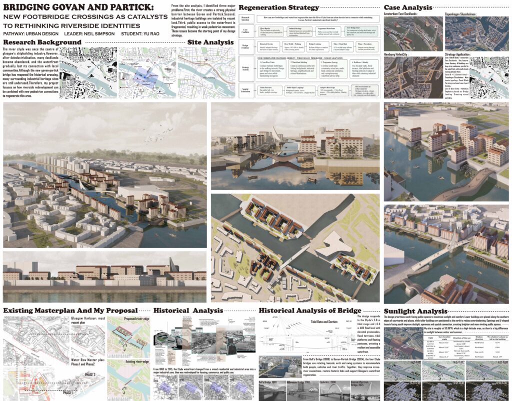
The explanation of the whole design project
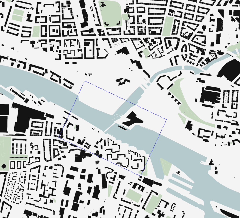
The area inside the blue outline is my design area
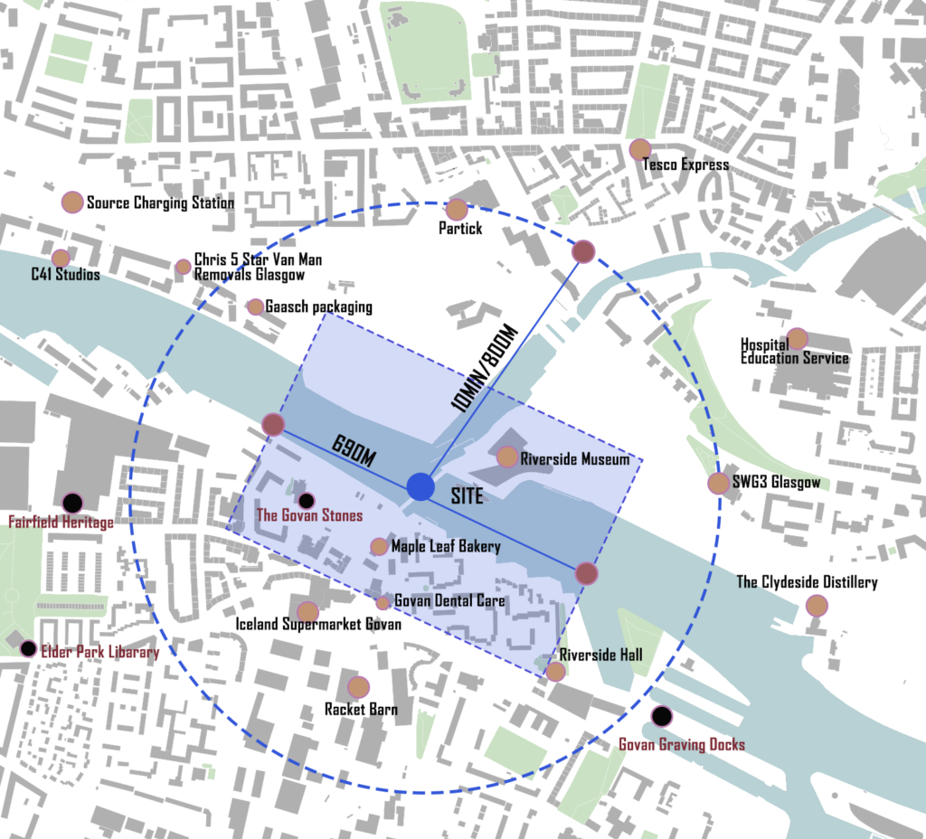
Three key spatial challenges were identified: fragmented urban fabric caused by industrial brownfields, an imbalance between built and open space that isolates heritage buildings, and limited pedestrian connectivity across the River Clyde. Together, these issues weaken urban vitality and the waterfront identity.
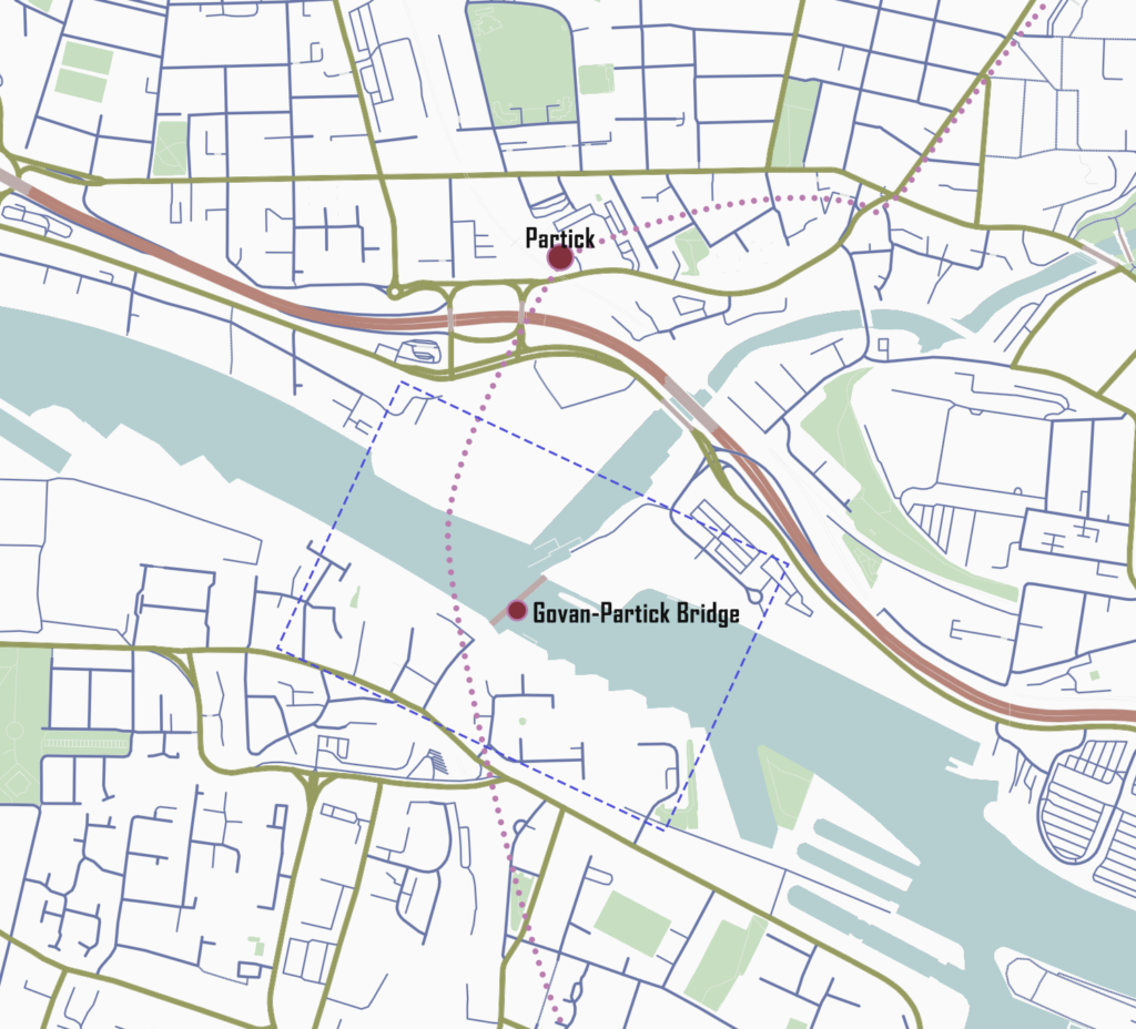
Despite improved access from roads, metro links and the new Govan–Partick Bridge, the river and abandoned industrial land continue to fragment the site. The bridge should therefore serve not only as infrastructure, but also as a framework for integrating waterfront development.
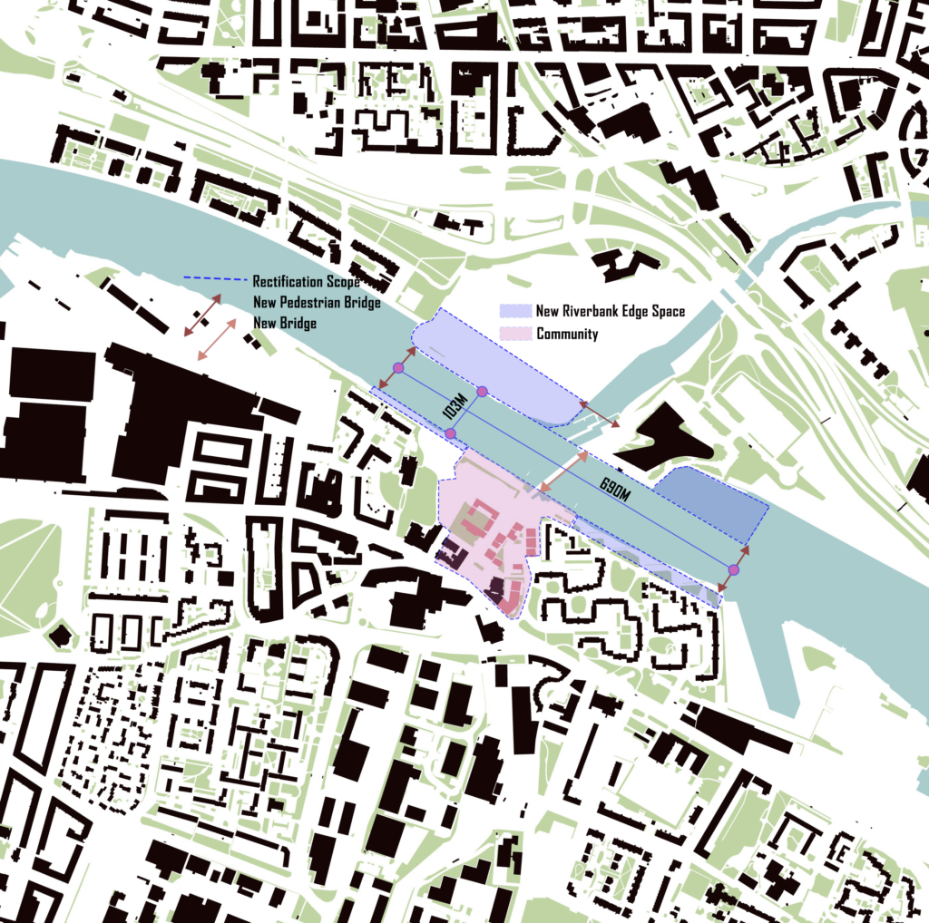
This diagram proposes new pedestrian bridges and river-edge spaces along the Govan–Partick stretch of the Clyde to connect communities, activate the waterfront and reduce spatial fragmentation.
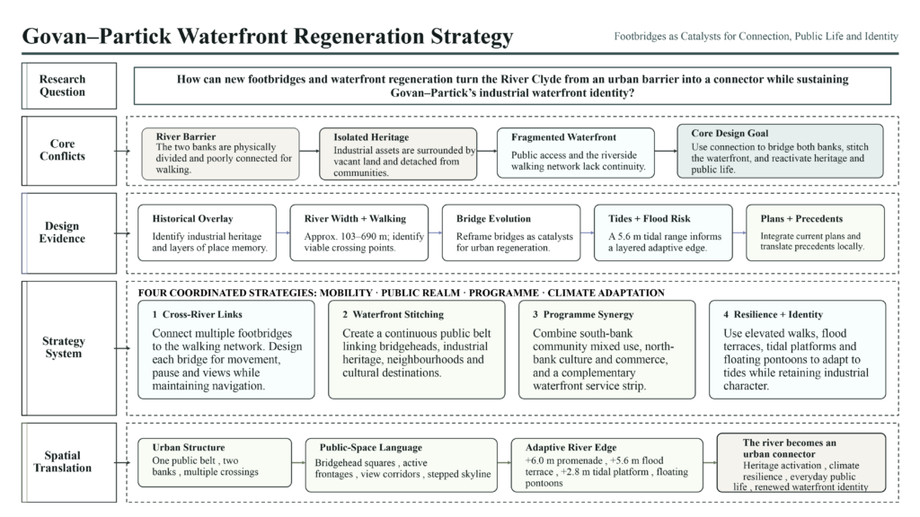
Regeneration Strategy
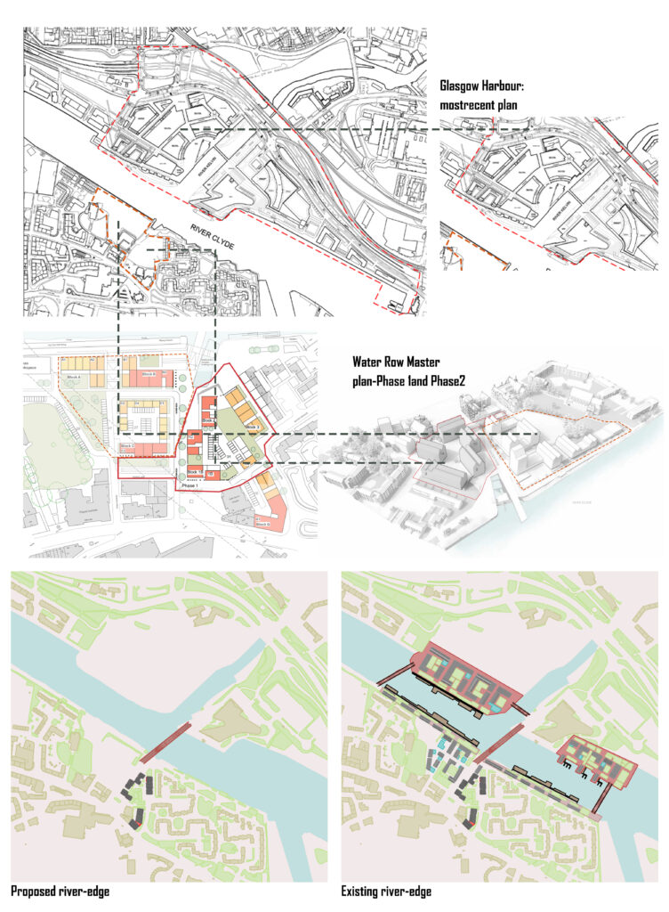
Comparing the Existing Masterplan and My Proposal
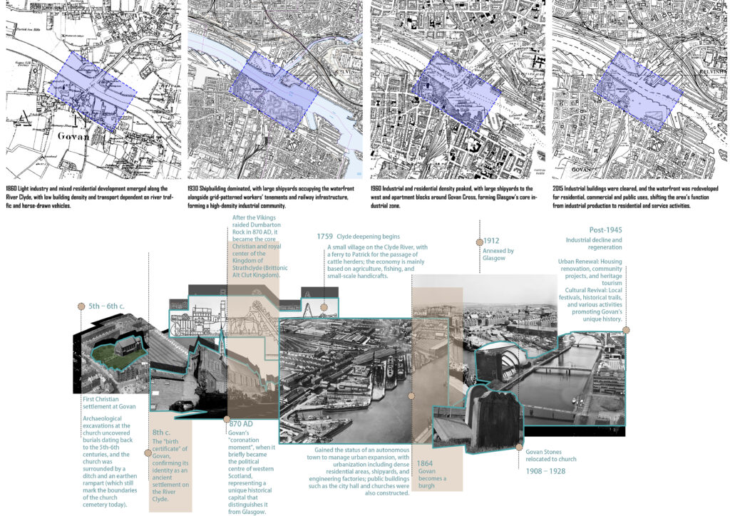
This diagram traces the urban evolution of Govan, Glasgow, from the 5th century to the present, with 1759 and 1864 as two pivotal milestones.
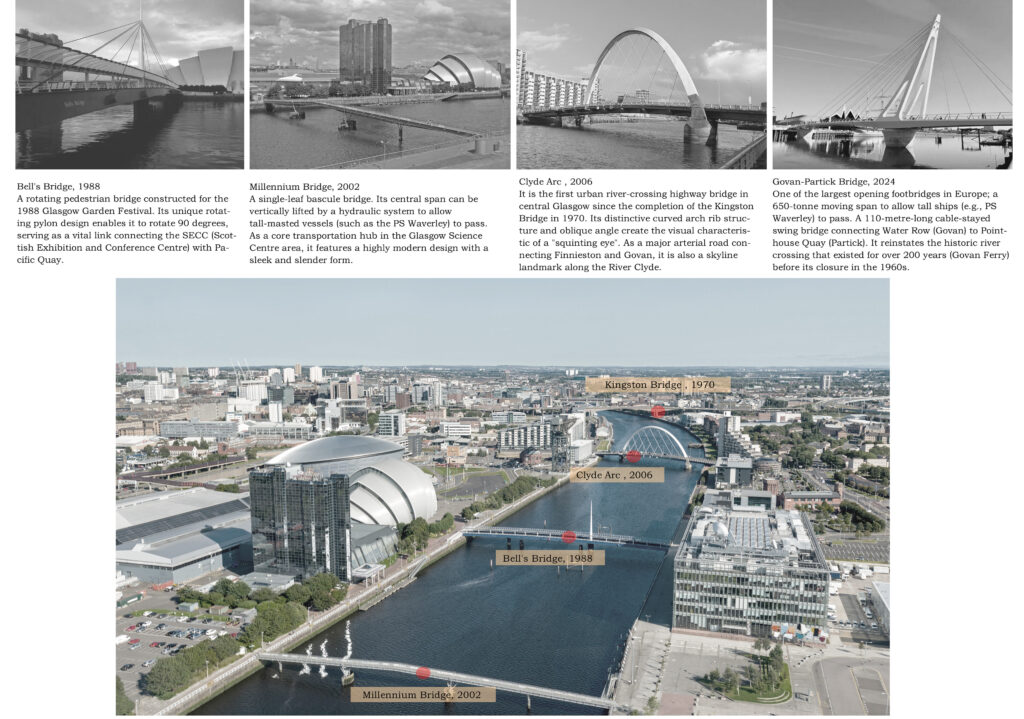
From Bell’s Bridge (1988) to the Govan–Partick Bridge (2024), four crossings reflect the Clyde waterfront’s transformation from an industrial landscape into contemporary communities. Their varied forms—rotating cable-stayed, single-leaf bascule, curved-arch road and cable-stayed swing bridges—demonstrate Glasgow’s innovation in waterfront connectivity.
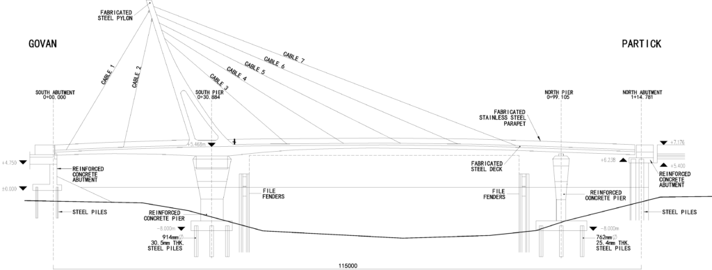
The design respondsto the Clyde's 5.6 mtidal range and +5.6m AOD flood level withelevated promenades,flood terraces, tidalplatforms and floatingpontoons, creating aresilient and accessiblewaterfront.
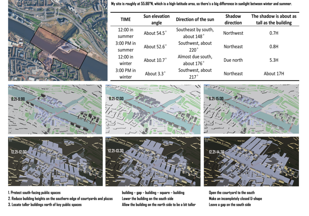
The design maximises sunlight by orienting public spaces south, with lower buildings along their southern edges and taller buildings to the north. South-facing openings and U-shaped layouts enhance daylight, openness and spatial connection.
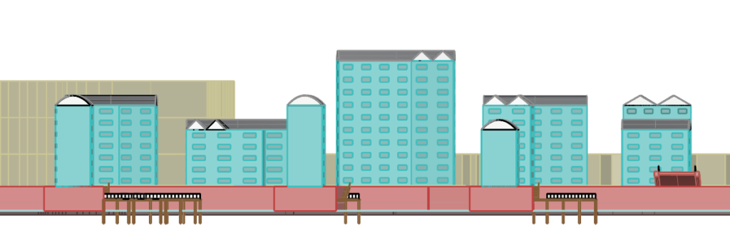
section analysis
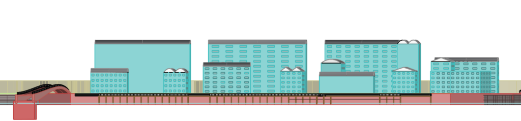
section analysis
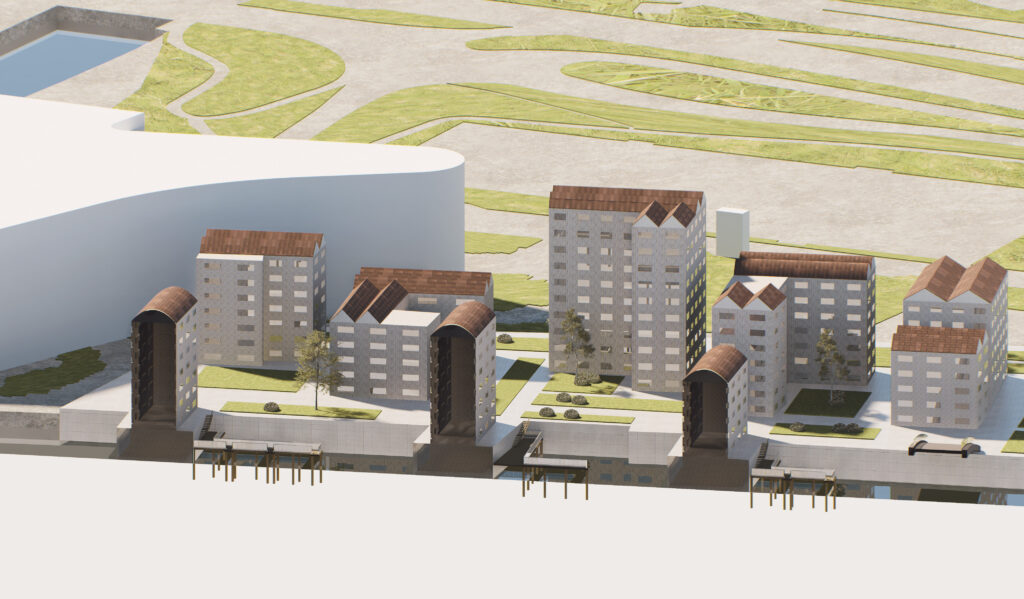
Bridging Govan and Partick: new footbridge crossings as catalysts to rethinking riverside identities
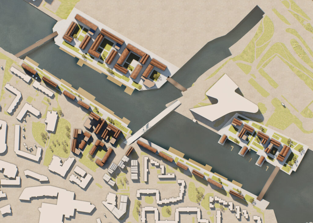
plan
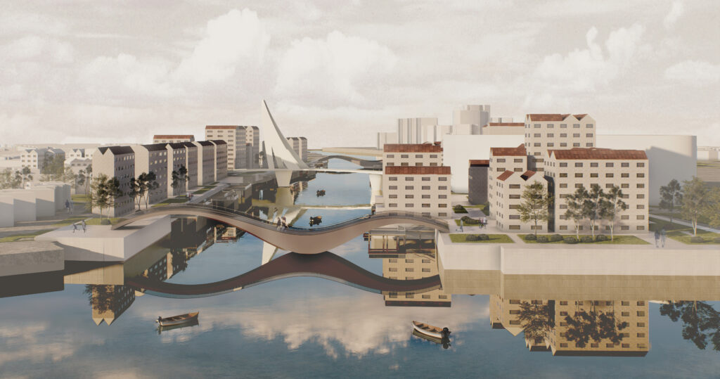
render
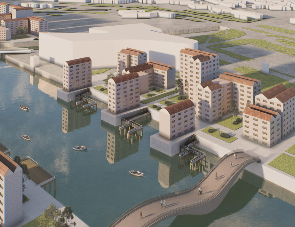
render
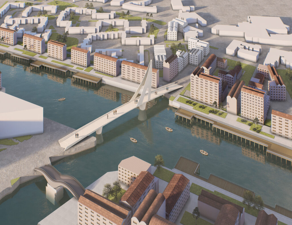
render
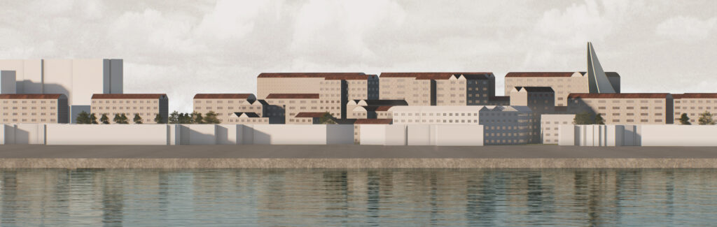
elevation